Know it! - Mapping - Year 6
Geography Resource Description
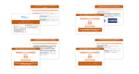
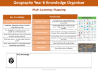
Maps are essential tools for navigation and understanding our surroundings. In a Year 6 educational setting, students learn the significance of maps through various engaging activities. One such activity involves interpreting Ordinance Survey symbols, which are key to understanding the features and landmarks depicted on maps. These symbols act as a universal language for map readers, allowing them to identify terrain types, buildings, and points of interest. Students are allotted 15 minutes to match symbols with their meanings, reinforcing their map-reading skills and enhancing their ability to navigate the world around them.
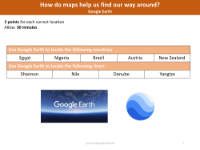
Another critical aspect of map literacy is the ability to use grid references to pinpoint exact locations. Year 6 students are challenged to write six-figure grid references for several locations, such as Old Dane, Sports Centre, and Fistral Beach Car Park. This exercise, which also has a 15-minute time allowance, helps students to become adept at finding precise locations on maps, a skill that is invaluable for both academic purposes and real-world applications. Additionally, students explore time differences across various countries, calculating the local time in places like India, Egypt, and Canada relative to the UK. This task enhances their understanding of global geography and time zones. To further expand their geographical knowledge, students use Google Earth to locate countries and rivers, gaining familiarity with digital mapping tools and the diverse landscapes of our planet.