Locating counties in the UK - Worksheet - Year 3
Geography Resource Description
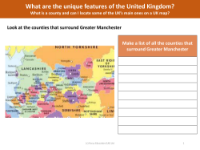
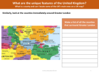
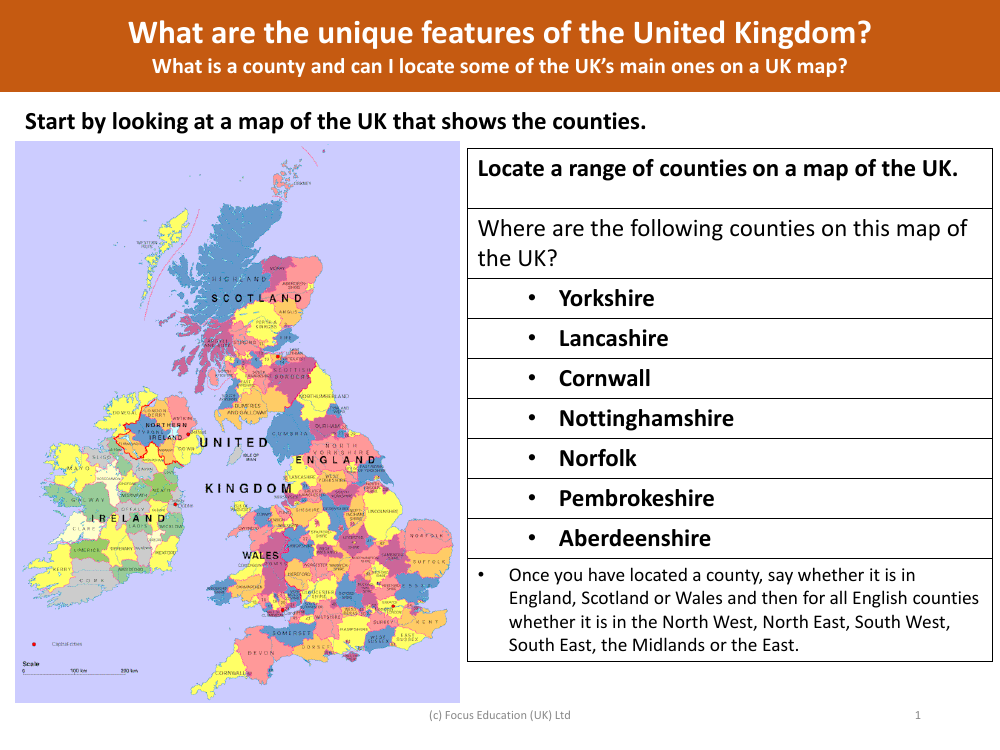
In this engaging worksheet designed for Year 3 pupils, children are encouraged to explore the geography of the United Kingdom by identifying and locating various counties on a map. The activity begins with the students examining a map that clearly delineates the UK's counties. They are tasked with finding specific counties, including Yorkshire, Lancashire, Cornwall, Nottinghamshire, Norfolk, Pembrokeshire, and Aberdeenshire. As they pinpoint each county, they must identify whether it is situated in England, Scotland, or Wales. For the counties located in England, the task extends to determining which region the county belongs to, such as the North West, North East, South West, South East, the Midlands, or the East.
The worksheet presents an excellent opportunity for children to gain a deeper understanding of the UK's administrative divisions and the concept of a county. It also prompts them to consider the unique features that make up the United Kingdom. By engaging in this interactive activity, students not only enhance their geographical knowledge but also develop their map-reading skills and their ability to associate places with their respective national and regional contexts. This foundational exercise lays the groundwork for a more comprehensive understanding of the UK's diverse landscapes and cultural regions.