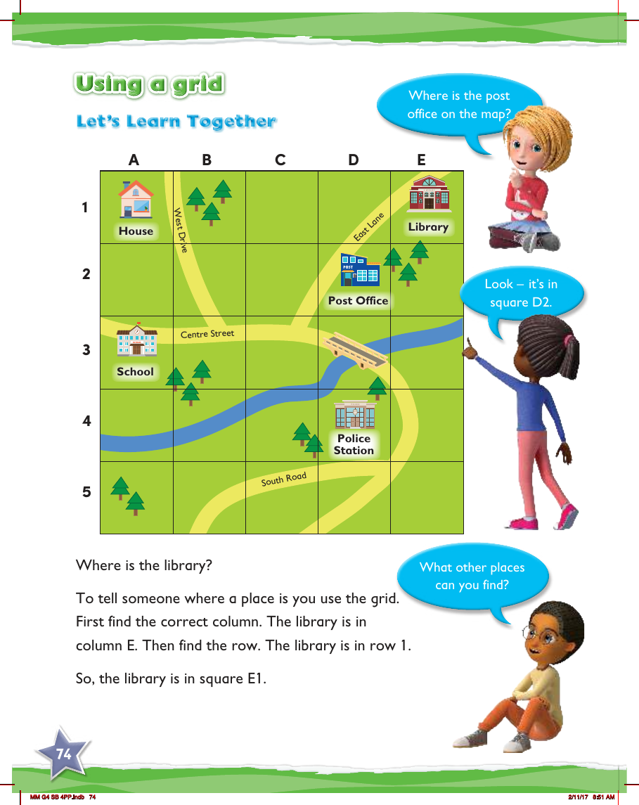
Max Maths, Year 4, Learn together, Using a grid
Maths Resource Description
In this educational activity designed for Year 4 students, children are introduced to the concept of using a grid to locate places on a map. The grid is labelled with letters across the top, representing columns, and numbers down the side, representing rows. The map features various landmarks such as a house, school, post office, library, and police station, all situated on streets with names like Centre Street, West Drive, East Lane, and South Road. To find a specific location, students must first identify the correct column and then the corresponding row.
For instance, to locate the library, students are instructed to look for the column marked 'E' and then find row '1'. This places the library in square E1 on the grid. The activity encourages students to apply this method to find other places on the map. Another example is given with the post office, which is found in square D2. This exercise not only helps students understand how to use grid references but also aids in developing their spatial awareness and map-reading skills.