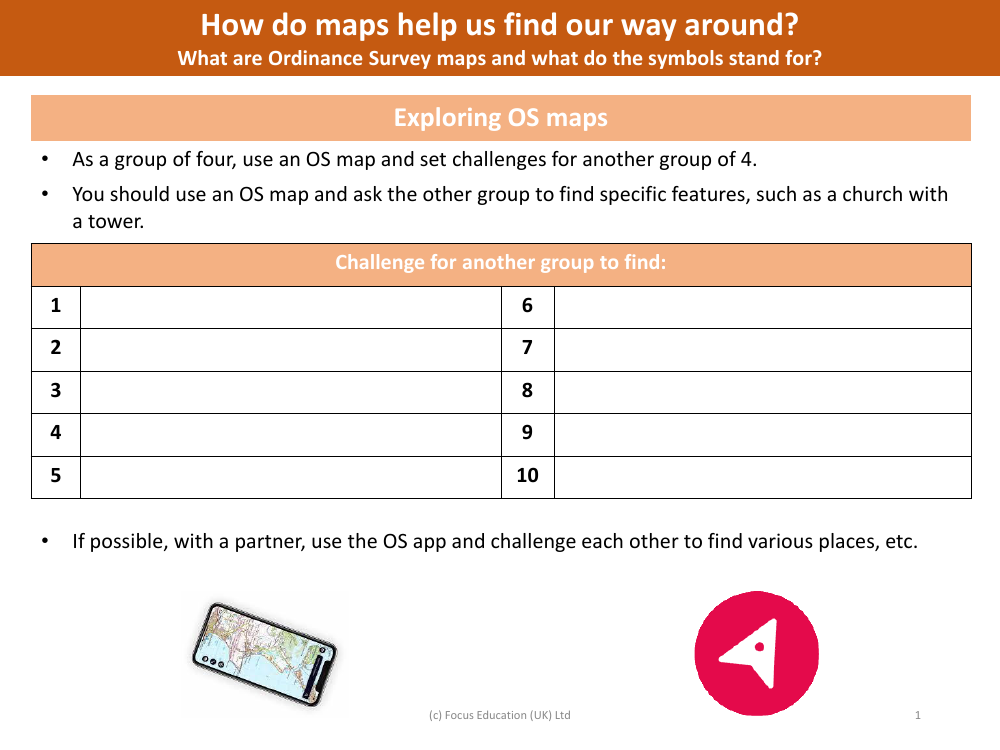
OS map challenge
Geography Resource Description
The OS map challenge is an interactive group activity designed to enhance navigation skills and map reading proficiency using Ordnance Survey (OS) maps. In this challenge, groups of four collaborate to create and set tasks for another team, with the aim of locating specific landmarks and features indicated on the map. The tasks are numbered from 1 to 10, each directing the participants to identify a different feature, such as a church with a tower, on their OS maps. This engaging exercise not only fosters teamwork but also improves understanding of geographical symbols and map interpretation.
For those with access to digital resources, the challenge can be extended through the use of the OS map app. Partners can use the app to set real-time challenges for each other, searching for various places and points of interest. This activity prompts participants to consider how maps are vital tools for navigation, allowing us to traverse and understand our surroundings with greater ease. Ordnance Survey maps are particularly detailed, with a wide array of symbols representing different topographical features, which participants will become familiar with as they undertake the map challenges. Through these exercises, learners gain practical experience in using maps to find their way and decode the rich information that Ordnance Survey maps provide.