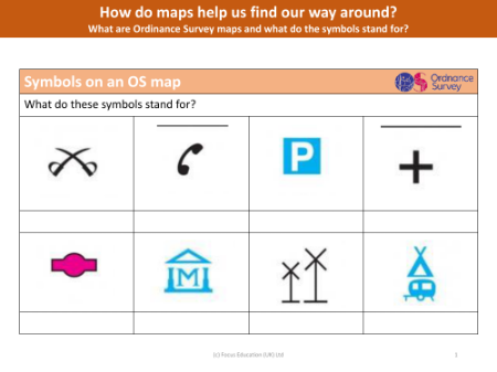
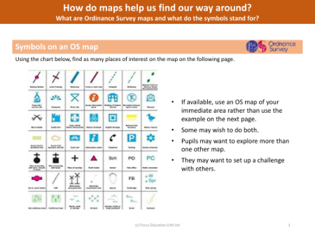
What are Ordinance Survey maps and what do the symbols stand for?
Lesson
Geography
Year 6
Presentation
Resource 1/5
Premium
Focus Education
Geography Lesson Description
Editable presentation
Group work
Active
Discussion based learning
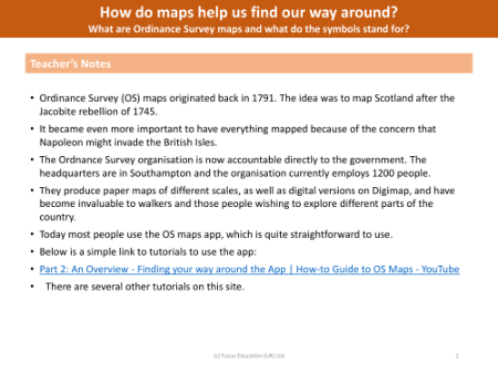
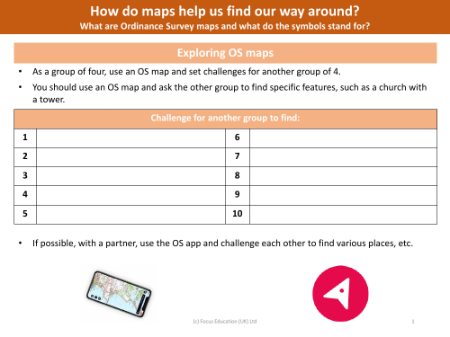
Year 6 Geography lesson from the unit Mapping. This lesson uses an enquiry-approach method, and will facilitate students answering the question 'What are Ordinance Survey maps and what do the symbols stand for?'
Lesson contents
Unlimited access to 30,000+ resources
All subjects
National Curriculum Coverage
Award-winning content
Explore other content in this scheme
Part of a unit by Focus Education

Other lessons in this unit
1. What are digimaps and how can they be used to help find out more about the local area?
Lesson
Geography
Y6

2. How can Google Earth help to find out more about the world and its continents?
Lesson
Geography
Y6

4. How can I use six-figure grid references?
Lesson
Geography
Y6
5. Why do we have time zones and how do they work?
Lesson
Geography
Y6
This website uses cookies to enhance the user experience.
To get more information about these cookies check our
Hey! It looks like you're in the United States.
Stay on the UK site
Switch to the US site