How can a relief map be transformed into a model of a mountain? - Presentation

Geography Resource Description
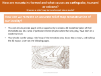
Transforming a relief map into a model of a mountain is an engaging educational task, designed to deepen students' understanding of topographical maps and the physical geography of their locality. This unit is acknowledged as challenging, focusing on disciplinary knowledge that not only teaches pupils how to interpret maps, but also how these maps correspond to real-world terrain. To accomplish this, students are encouraged to work in groups and may require guidance throughout the process. Ideally, a relief map of the local area is used, or if the local area lacks significant elevation changes, a more varied terrain can be selected for the exercise.
The process begins with students discussing and familiarising themselves with relief maps and the concept of contours. They then identify and trace specific contour lines, such as the 50m or 100m elevation marks, onto thick card, which they cut out and label with the corresponding height. By repeating this for successive contour lines and layering the cut-outs, students gradually build a 3D model. The model can be further refined by painting or using plaster for a more realistic effect, resulting in a tactile and visual representation of the landscape. This hands-on approach helps students to visualise how mountains are formed and provides context for understanding natural phenomena such as earthquakes, tsunamis, and volcanoes.


