How do we use a local map to find the streets around the school? - Presentation
Geography Resource Description
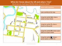
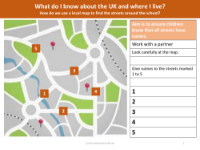
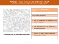
Understanding how to navigate using a local map is an essential skill, particularly for children learning about their immediate environment. A presentation by Focus Education provides a comprehensive guide on how to use a local map to find streets around a school. The unit begins with an instructional video, followed by practical exercises using a street map. Pupils are tasked with identifying specific landmarks such as schools, post offices, and churches, marked with universally recognized symbols like 'Sch' for school and '+' for church. This interactive approach helps children to associate symbols with real-world locations.
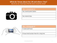
The lesson extends to naming streets on a fictional map, which aids in recognizing different types of street names, such as 'crescent', 'road', and 'avenue'. Additionally, the use of a map of the area surrounding the school allows pupils to locate their own houses and familiarize themselves with their neighbourhood. Fieldwork activities include taking photographs of local places and sketching interesting features, which are then incorporated into the map, providing a visual and practical understanding of the local geography. The aim is to ensure that children not only know how to read a map but also appreciate the significance of street names and local landmarks in the context of their daily lives.