Bearings Help Sheet - Outdoor and Adventurous Activities
Physical Education Resource Description
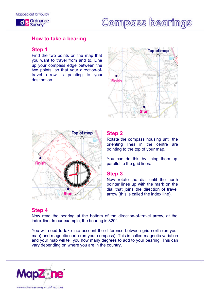
The Bearings Help Sheet provides a clear step-by-step guide on how to accurately take a bearing during outdoor and adventurous activities, ensuring that navigators can travel from one point to another with confidence. Initially, one must locate the two points on the map between which they wish to travel. The compass is then aligned so that its edge joins the two points, with the direction-of-travel arrow pointing towards the intended destination. This simple yet crucial step sets the foundation for an accurate bearing.
Subsequent steps involve adjusting the compass housing so that the orienting lines within it are parallel to the map's grid lines, effectively pointing to the top of the map. The user then rotates the compass dial until the north pointer aligns with the index line, which is in line with the direction-of-travel arrow. The bearing can then be read from where the index line intersects the dial, for example, 320°. It's important to account for magnetic variation—the discrepancy between grid north and magnetic north—by adjusting the bearing accordingly, as indicated on the map. Finally, the compass is reoriented so that the magnetic needle aligns with the orienting arrow, and the navigator can follow the direction-of-travel arrow to reach the destination. Regular bearings should be taken to maintain the correct course, especially over longer distances where a small error can lead to a significant deviation from the intended route. Shortening the journey into manageable sections and taking bearings from identifiable landmarks can help maintain accuracy throughout the journey.
