How can Google Earth help to find out more about the world and its continents? - Teacher notes

Geography Resource Description
Google Earth is a powerful tool that can enhance our understanding of the world and its diverse continents. Teachers can introduce students to this virtual globe by starting with a basic tutorial, which can be found on platforms like YouTube. This initial step is designed to help learners navigate the software and become comfortable with its features. Once acquainted with Google Earth, students can embark on a digital exploration of each continent, examining real-time data such as temperature and rainfall to gain insights into different locations around the globe. This immersive experience not only captures the essence of each place but also serves as an interactive geography lesson.
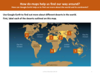
The educational journey continues as pupils focus on specific biomes, such as deserts, using Google Earth to explore these unique ecosystems in detail. By allowing students to virtually visit various terrains, they can better comprehend the world's environmental diversity. Google Earth also offers the ability to follow the course of a river, scale the heights of a mountain, or even locate their own school. This hands-on approach to learning geography encourages curiosity and a deeper appreciation for the planet's geography, providing a dynamic way for students to connect with the world beyond their classroom.


