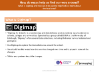
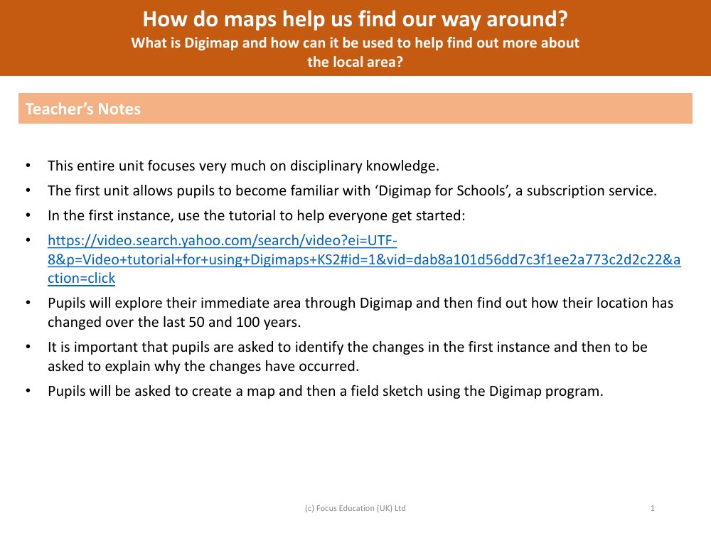
What are digimaps and how can they be used to help find out more about the local area? - Teacher notes
Geography Resource Description
Digimaps are a digital mapping service designed to support education by providing access to a range of Ordnance Survey maps and geographical information. This service is particularly beneficial for schools, as it helps to enhance pupils' understanding of geography and their local environment. By subscribing to 'Digimap for Schools', teachers can introduce students to this resource and utilise the available tutorials to get everyone acquainted with how the system operates. The interactive nature of Digimaps allows pupils to explore their immediate surroundings and investigate how their local area has evolved over the past decades, looking specifically at changes over the last 50 and 100 years.
Through the use of Digimaps, students are encouraged to actively engage with the maps to identify changes in the local area, fostering critical thinking as they hypothesise the reasons behind these developments. This exploration is not only about observing differences but also understanding the factors that contribute to urban or rural transformation. Additionally, Digimaps provides tools for pupils to create their own maps and field sketches, further deepening their geographical skills and knowledge. By integrating Digimaps into the curriculum, teachers can provide a dynamic and interactive learning experience that aids students in interpreting maps, understanding spatial relationships, and navigating their way through the world around them.