What are digimaps and how can they be used to help find out more about the local area? - Presentation
Geography Resource Description
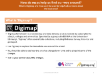
Digimap is an educational online mapping tool designed for schools, which provides access to a range of current and historical maps. It is particularly useful for Year 6 geography students as it aligns with the National Curriculum requirements for understanding and using maps. By utilising Digimap, students can explore their local area in great detail, observing changes over time. This tool allows for an interactive investigation of the immediate surroundings, enabling students to identify and discuss the development of their local area over the last 50 to 100 years. Digimap facilitates the creation of maps and field sketches, providing a dynamic platform for students to engage with geographic information and enhance their spatial awareness.
Within the classroom setting, Digimap can be used to create accurate maps of the school's vicinity, including identifying local landmarks such as the school building, post offices, and supermarkets. Students can compare the present-day map with those from 50 and 100 years ago, noting the differences and reflecting on the reasons behind these changes. The tool also supports the development of geographical skills, such as creating labelled field sketches of interesting local features. The quality of these sketches is expected to meet a high standard, with clear labels and details. Overall, Digimap serves as a valuable resource for students to conduct geographical enquiries and present their findings, fostering a deeper understanding of their local environment.