Locate on a map - Mountain regions
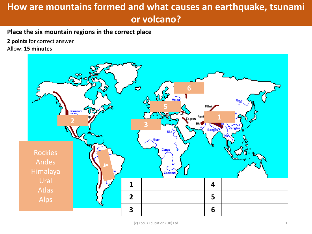
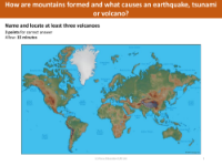
In a geography-based activity, students are tasked with identifying the locations of six major mountain regions on a map. The regions specified are the Rockies, Andes, Himalaya, Ural, Atlas, and Alps. The exercise requires pupils to match each mountain range with its corresponding number on the map, with two points awarded for each correct answer. This task not only tests the students' knowledge of world geography but also their ability to associate mountain ranges with their geographical positions. A time allowance of 15 minutes is provided for the completion of this activity, ensuring that students have ample time to think and place each mountain range accurately.
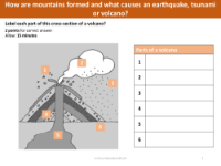
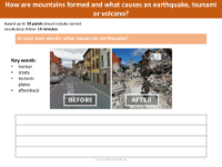
Furthermore, the activity extends into the dynamic processes that shape our planet's surface. Students are prompted to explore the natural phenomena that lead to the formation of mountains, as well as the causes behind earthquakes, tsunamis, and volcanic eruptions. This part of the lesson delves into the Earth's geology and tectonic activity, providing a comprehensive understanding of how these massive geological structures come to be and how they can influence catastrophic natural events. The aim is to give students a rounded grasp of both the static locations of mountain ranges and the dynamic forces that continue to mold the Earth's landscape.