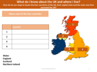
Where do you live on the map?
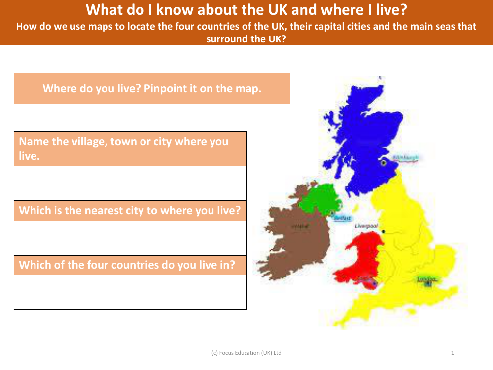
The given text appears to be an excerpt from an educational resource or lesson plan, aimed at teaching students about the geography of the United Kingdom. The questions are designed to encourage pupils to think about their own location within the UK and to identify their local area in relation to larger cities and the four constituent countries of the UK. By asking students to name the village, town, or city where they live, and to identify the nearest city, the resource helps them to contextualise their own place within the broader geography of the nation.
Furthermore, the text prompts learners to use maps as a tool to locate the four countries of the UK—England, Scotland, Wales, and Northern Ireland—along with their capital cities and the surrounding seas. This activity not only reinforces their understanding of maps as navigational aids but also enhances their knowledge of the UK's political and physical geography. The final instruction to 'pinpoint' their location on a map serves as a practical application of the lesson, enabling students to engage directly with the concepts being taught.