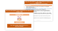
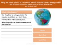
How can you use maps and the globe to locate the equator, the North Pole and the South Pole? - Presentation
Understanding the geographical features of our planet is a fundamental aspect of the Geography Key Stage 1 curriculum. Children learn to identify the Equator, an imaginary line that encircles the globe, dividing it into the Northern and Southern Hemispheres. It is positioned equidistant from the North and South Poles, which are the utmost points on the Earth along its axis. The North Pole is located at the top of the world map, while the South Pole is at the bottom. Globes and maps serve as essential tools for locating these significant landmarks. A globe, being a 3D representation of the Earth, offers a realistic perspective of the Earth's surface, whereas a map provides a 2D depiction. Through the use of these educational resources, children also gain an appreciation for the extreme weather conditions experienced near the Equator and the poles, understanding why some regions are perpetually hot or cold.
Further exploration into the subject reveals how people and animals have adapted to survive in such contrasting climates. In Year 1 Geography, students delve into the reasons behind the constant heat in equatorial regions and the persistent cold at the poles. They learn to use a compass, identifying the cardinal directions—North, East, South, and West—which aids in navigating and understanding the Earth's geography. Discussions about the main differences between a map and a globe help solidify their spatial awareness. By engaging with these educational materials, children not only locate the Equator, North Pole, and South Pole but also begin to comprehend the environmental characteristics and living conditions of the inhabitants in these areas.