Long-term overview - Rivers - Year 3
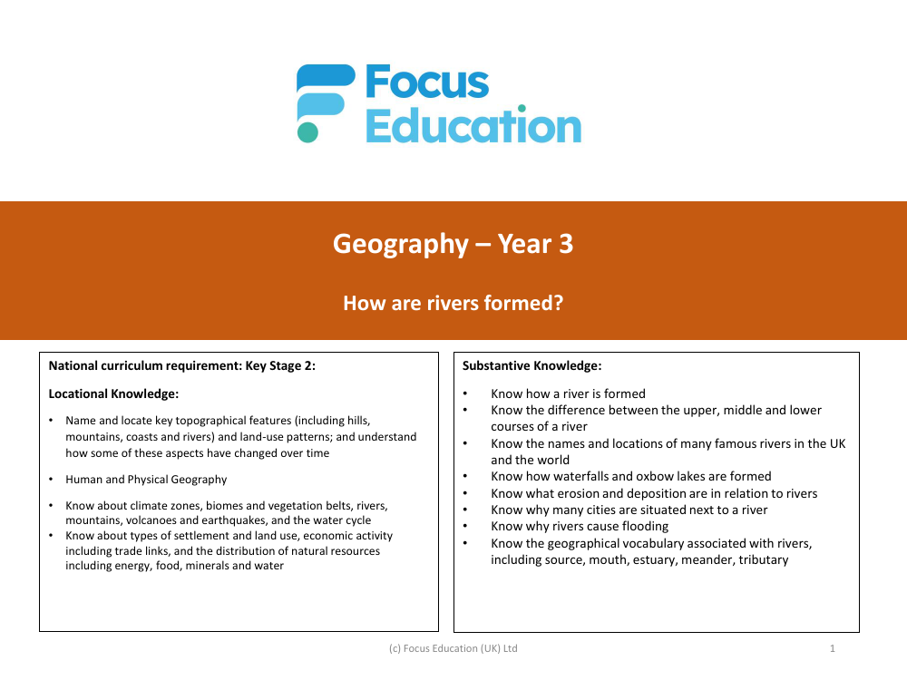
The Year 3 Geography curriculum provides students with a comprehensive understanding of rivers, integrating locational knowledge, substantive knowledge, and disciplinary knowledge. The National Curriculum for Key Stage 2 outlines the requirement for students to name and locate key topographical features like rivers, and to understand changes in land-use patterns over time. They are also expected to acquire knowledge about physical geography, including the formation and features of rivers, climate zones, and the water cycle, as well as human geography aspects such as types of settlements, economic activities, and the distribution of natural resources.
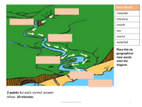
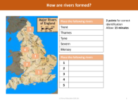
Substantive knowledge focuses on the specifics of how rivers are formed and the characteristics that distinguish the upper, middle, and lower courses of a river. Students learn about the names and locations of significant rivers both in the UK and worldwide, the formation of waterfalls and oxbow lakes, and the processes of erosion and deposition. They explore the reasons behind the establishment of cities near rivers and the causes and impacts of river flooding. The curriculum ensures that students are familiar with the geographical vocabulary associated with rivers, including terms like source, mouth, estuary, and tributary. Disciplinary knowledge is developed through geographical skills and fieldwork, where students use maps and digital tools to locate and study rivers, create models to illustrate river features and processes, and conduct local river surveys with field sketches to apply their theoretical knowledge in a practical context.