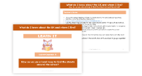
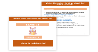
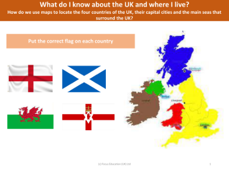
How do we use maps to locate the four countries of the UK, their capital cities and the main seas that surround the UK?
Lesson
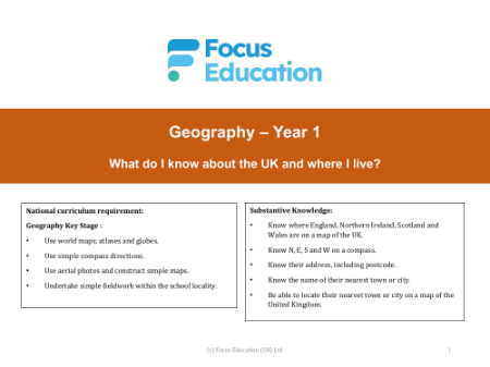
Geography
Year 1

How do we use maps to locate the four countries of the UK, their capital cities and the main seas that surround the UK? - Presentation
Resource 1/7
Premium
Focus Education
Description
Editable presentation
Group work
Active
Discussion based learning
Year 1 Geography lesson from the unit My local area. This lesson uses an enquiry-approach method, and will facilitate students answering the question 'How do we use maps to locate the four countries of the UK, their capital cities and the main seas that surround the UK?'
Lesson contents
Resources
How do we use maps to locate the four countries of the UK, their capital cities and the main seas that surround the UK? - Presentation
Resource
Geography
Y1
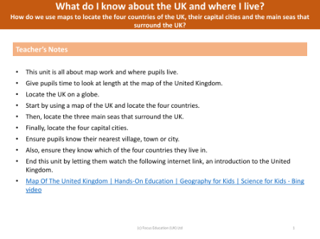
How do we use maps to locate the four countries of the UK, their capital cities and the main seas that surround the UK? - Teacher notes
Resource
Geography
Y1
Picture match - Countries of the UK
Resource
Geography
Y1
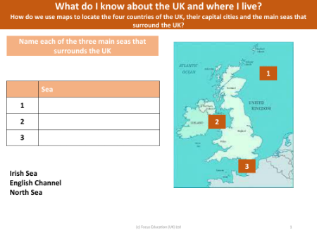
Picture match - Seas around the UK
Resource
Geography
Y1
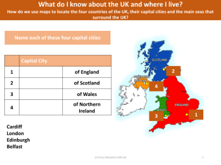
Picture match - Capital cities of the UK
Resource
Geography
Y1
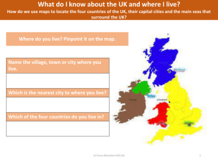
Where do you live on the map?
Resource
Geography
Y1
Picture match - Flags of UK countries
Resource
Geography
Y1
Lesson contents
Resources
How do we use maps to locate the four countries of the UK, their capital cities and the main seas that surround the UK? - Presentation
Resource
Geography
Y1
How do we use maps to locate the four countries of the UK, their capital cities and the main seas that surround the UK? - Teacher notes
Resource
Geography
Y1
Picture match - Countries of the UK
Resource
Geography
Y1
Picture match - Seas around the UK
Resource
Geography
Y1
Picture match - Capital cities of the UK
Resource
Geography
Y1
Where do you live on the map?
Resource
Geography
Y1
Picture match - Flags of UK countries
Resource
Geography
Y1
Explore other content in this scheme
Part of a unit by Focus Education
Other lessons in this unit