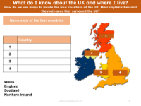
How do we use maps to locate the four countries of the UK, their capital cities and the main seas that surround the UK? - Presentation
Resource
Geography
Kindergarten
Premium
Focus Education
Description
Editable presentation
'How do we use maps to locate the four countries of the UK, their capital cities and the main seas that surround the UK? - Presentation' is a resource from 'Which animals will we find living naturally in very hot or very cold climates?', a Kindergarten Geography lesson from the unit Hot and Cold. This lesson uses an enquiry-approach method, and will facilitate students answering the question 'Which animals will we find living naturally in very hot or very cold climates?'
Explore other content in this scheme
Part of a lesson by Focus Education
Other resources in this lesson
How do we use maps to locate the four countries of the UK, their capital cities and the main seas that surround the UK? - Teacher notes
Resource
Geography
Kindergarten
Picture match - Countries of the UK
Resource
Geography
Kindergarten
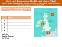
Picture match - Seas around the UK
Resource
Geography
Kindergarten
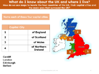
Picture match - Capital cities of the UK
Resource
Geography
Kindergarten
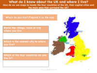
Where do you live on the map?
Resource
Geography
Kindergarten
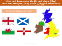
Picture match - Flags of UK countries
Resource
Geography
Kindergarten